Below you'll find interactive 3D models of derelict properties in Ireland captured using consumer-grade LiDAR technology. These models demonstrate how accessible technology can be used to document and assess abandoned buildings for potential renovation and repurposing.
You can interact with each model by:
- Clicking and dragging to rotate the view
- Scrolling to zoom in and out
- Right-clicking and dragging to pan the view
- Using the toolbar on the bottom of each viewer for additional options
"LIDAR technology and photogrammetry integrated with smart phones has really transformed the way derelict buildings are viewed for renovation assessment." - Des at DOD Construction Technical Services Ltd, 2025
Derelict Bungalow - Carlow
Fig 1: 3D model of derelict bungalow in Carlow captured with iPhone using LiDAR technology
Scan Time: 2 Hours
Building Type: Early 1900's Derelict Cottage
Condition: Moderate deterioration, structural integrity maintained
Key Features: Original mouldings, fireplace features, 473sq ft
Non-textured Structural Model
Fig 2: Non-textured structural model showing precise dimensional data without visual textures
Generated Floor Plan
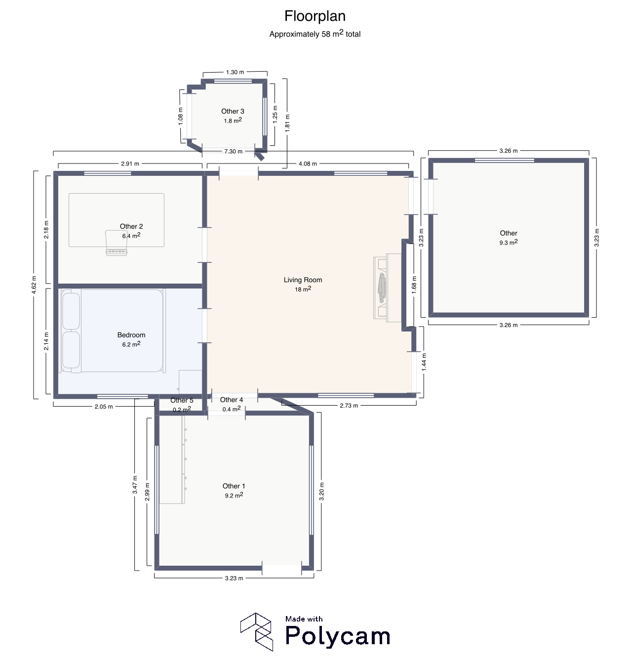
Fig 3: Floor plan generated from LiDAR scan data showing room dimensions and spatial layout
Video Walkthrough Demo
Watch a video demonstration of the LiDAR scanning process and see how the technology works in real-time.
About This Demonstration
This video shows the complete workflow of capturing a derelict property using LiDAR technology with
Equipment Used in Demo
iPhone 16 Pro
Primary LiDAR capture device
Polycam App
LiDAR scanning software
Sketchfab
For 3D model host
Accuracy Comparison: LiDAR vs Traditional Measurement
The table below compares measurements taken using traditional methods against those obtained from LiDAR scans. The analysis demonstrates the high degree of accuracy achieved with consumer-grade technology.
Table 1: Comparison of measurements from 5 key structural elements in the Bungalow case study.
The average deviation of only 8.2cm between traditional and LiDAR measurements demonstrates that consumer technology can achieve professional-grade accuracy for property assessment purposes.