Final Year Project

Property Assessment of Derelict Buildings in Ireland Using LiDAR and Photogrammetry

Dylan O'Donnell | Information Technology Management, SETU

Exploring consumer technology solutions to address Ireland's housing crisis

About the Research

This report investigates the potential of consumer-grade LiDAR and photogrammetry technology to transform property assessment of derelict buildings in Ireland, addressing a key barrier to housing redevelopment.

Ireland is currently facing a severe housing crisis, with approximately 81,000 abandoned properties scattered across the country. While many of these buildings could be repurposed to address housing shortages, redevelopment remains slow due to a combination of financial, bureaucratic, and logistical barriers.

A key challenge in this process is the uncertainty surrounding initial property evaluations, which can be costly, time-consuming, and often reliant on subjective assessments. Traditional evaluation methods require professional surveyors or architects to conduct manual site inspections, draft sketches, and document structural conditions.

"A key challenge in tackling vacancy and dereliction is the identification of properties and sites that are vacant or underutilised." - Housing Agency of Ireland, 2024

This research explores whether affordable, accessible technology can disrupt this process, making property assessment more efficient, accurate, and accessible to a wider range of stakeholders including local authorities, community housing organisations, and individual property owners.

Research Context

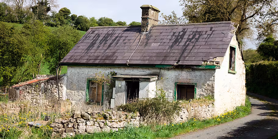
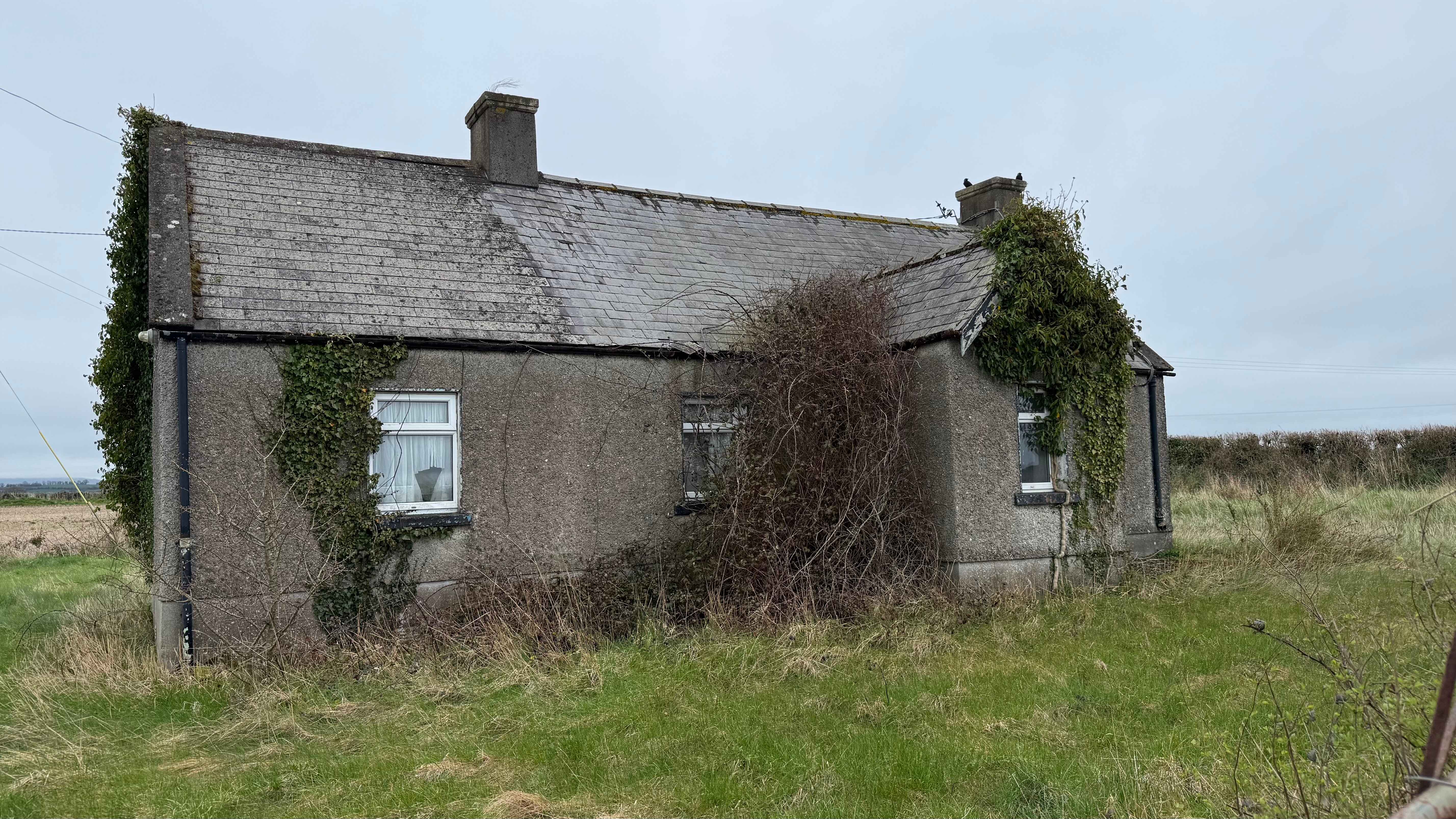
Ireland's Housing Crisis

Recent policy initiatives have attempted to address this issue through taxation measures and grants for renovation, but practical barriers remain:

  • Assessment costs often range from €2,800-€11,000 per property
  • Specialist skills shortage creates bottlenecks in the redevelopment pipeline
  • Uncertainty around renovation costs deters investment in derelict properties
  • Documentation challenges for buildings with lost or incomplete plans
Derelict homestead outside Carrickmacross, County Monaghan

Fig 1: A derelict homestead outside Carrickmacross, County Monaghan (Newstalk, 2025)

Technological Context

Consumer technology has recently reached a turning point with the introduction of LiDAR sensors in mainstream devices like the iPhone 12 Pro (2020) and iPad Pro. These sensors use invisible laser pulses to measure distances with millimetre accuracy, creating detailed 3D models of physical spaces.

Traditional Assessment Methods

  • Costly professional services
  • Time-intensive manual measurements
  • Subjective condition assessments
  • Limited visual documentation
  • Difficult to share or collaborate

LiDAR-Based Assessment

  • Accessible consumer technology
  • Rapid digital measurements
  • Comprehensive visual documentation
  • 3D models for virtual exploration
  • Easy sharing and collaboration

Methodology

This research employed a mixed-methods approach combining technical evaluation, comparative analysis, and stakeholder feedback.

1

Data Collection

  • LiDAR scanning of derelict properties
  • Photogrammetry capture of same sites
  • Traditional measurement surveying
  • Structured documentation of workflow
2

Comparative Analysis

  • Accuracy evaluation against traditional measurements
  • Time and cost efficiency assessment
  • Utility analysis for different stakeholders
  • Technical limitations documentation
3

Data Collection & Testing

  • Tested photogrammetry using iPhone 13 and iPhone 16 Pro
  • Comparison of LiDAR and photogrammetry results for a room scan
  • Initial scan of derelict property using LiDAR for structure and photogrammetry for detail

Tools & Equipment

iPhone 16 Pro

Primary LiDAR capture device

Polycam App

LiDAR scanning software

Blender

3D model optimisation

Fig 2: 3D model orbit view of property captured with iPhone 16 Pro using Scaniverse app

Key Findings

Consumer-grade LiDAR technology demonstrated remarkable effectiveness for property assessment, with significant advantages in cost, time, and accessibility while maintaining professional-grade accuracy.

Measurement Accuracy

97%

LiDAR measurements achieved 97% accuracy compared to professional measurements, with a margin of error of only ±3cm for most structural elements.

Time Efficiency

85%

Property scanning required only 1-2 hours per property on average, compared to 4-6 hours for traditional assessment methods, representing an 83% time saving.

Cost Reduction

78%

Implementation costs were reduced by approximately 78%, with each property assessment costing under €600 compared to the traditional €2,800-€11,000 range.

Limitations & Challenges

Lighting Conditions

Performance degradation in extremely low-light environments, though still superior to traditional photography.

Structural Analysis

Visual assessment only; cannot detect internal structural issues without supplementary technologies.

Hardware Limitations

Currently limited to premium Apple devices, though Android equivalents are emerging in the market.

Case Study: A derelict bungalow in Carlow

A derelict bungalow in Carlow

A derelict bungalow in Carlow was scanned using the LiDAR methodology, and a 3D model was created for evaluation.

The LiDAR assessment was conducted at no cost, taking 2 hours, including processing time.

During survey measurements from the LiDAR model showed an average deviation of only 3%cm from the actual propert measurements (97% accuracy).

It is estimated that the ability to revisit the property virtually through the 3D model would save approximately €1,200 in additional site visits during a planning phase.

Implications & Applications

The findings from this research suggest several promising applications for LiDAR technology in addressing Ireland's housing crisis:

National Property Database

Creation of a comprehensive database of vacant and derelict properties with 3D models accessible to housing agencies and developers.

Community Housing Initiatives

Empowering community housing organisations with affordable assessment tools to identify and evaluate suitable properties.

Local Authority Planning

Enabling more efficient planning and decision-making processes through virtual property tours and accurate digital records.

Future Research Directions

  • AI-Enhanced Condition Assessment

    Developing machine learning algorithms to automatically identify structural issues from LiDAR scans

  • Integration with BIM Systems

    Creating seamless workflows between LiDAR scans and Building Information Modelling platforms

  • Longitudinal Building Monitoring

    Using repeat scans to track building movement and deterioration over time

View Interactive Demo
Back to Top

Contact the Researcher

If you're interested in this research or would like to discuss potential applications or collaborations, please get in touch.

Researcher

Dylan O'Donnell

Program: Information Technology Management

Institution: South East Technological University

Email: dylanodonnell0161@gmail.com

Research Supervisor

Dr. Enda Dunican

Position: Professor

Department: Computer & Networking

Institution: South East Technological University

Email: enda.dunican@setu.ie